We’ve been enjoying our walks around Riseley for over 20 years. I thought it would be nice to share some of our favourites.

There is an Historical Walk described which takes you around Riseley showing the houses and people from previous generations.
We’ve been enjoying our walks around Riseley for over 20 years. I thought it would be nice to share some of our favourites.
There is an Historical Walk described which takes you around Riseley showing the houses and people from previous generations.
A six mile round trip from Riseley High Street to the the Keysoe Equestrian Centre. The Cafe at the Centre is open 7:30am to 3:00pm at the time of writing. It’s worth checking before you set off at their web site
https://www.keysoe.com/community-hub/
When wet it is a muddy walk in places, but refreshments at both ends make it a pleasant outing.
If you click on the map it will take you to the Ordnance Survey Map website.

Why not test yourself and the family while having a pleasant walk round Riseley village?
The quiz sheet was compiled in June 2022 to celebrate the Queen’s Jubilee. So I’m sorry to say that you’ve missed the opportunity to win a prize, also there is the possibility that one or two of the places in the quiz may have changed.
A copy of the answers is available to download too. But do that after the walk!
Download a copy of the quiz sheets below.
Download the answer sheet below.
A 4.5 mile walk avoiding ploughed fields , but taking in some nice woodlands. There are a couple of stiles on the footpath towards Sackville Lodge Nurseries from the High St, or away from the Nurseries, depending on what way you are walking.
It’s a pleasant stroll mainly around the fields North West of the High Street which takes about 1 hour 40 minutes. There is a short section from Town Farm to Keysoe Road on the other side of the High Street along the Flood Path, the escape route when the High Street is under water!
I have shown the walk starting and finishing at the village shop, but there are plenty of other points to start and finish the route.

About 6 miles, about 2hrs and 15 mins walking with a few short cuts possible and extensions.
A very pleasant walk from the centre of Riseley over the fields to Knotting Green. The paths take you through a beautiful wildlife sanctuary as you approach Strawberry Hill Farm from Riseley and as you head back along manicured pathways alongside the fields. Lots to see and enjoy.

7.3 miles takes about 2h 45min
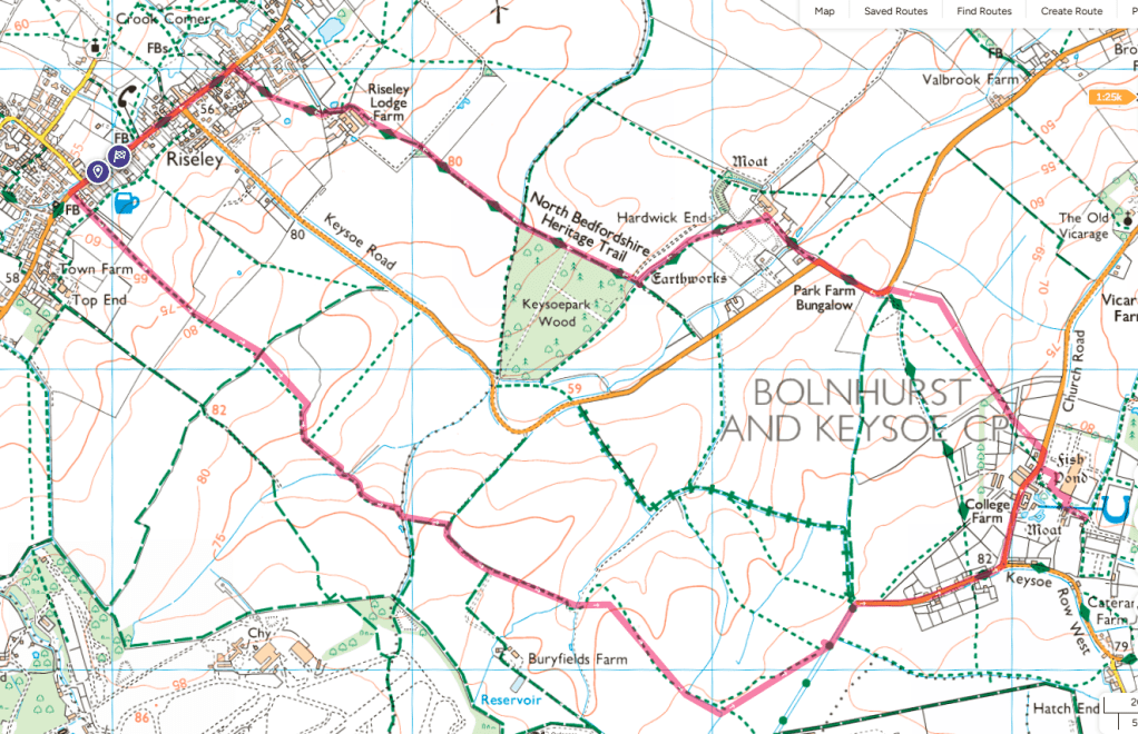
This walk takes you along the track on the ridge between the Swineshead road and Kimbolton Road so you get some lovely views across the countryside. If you’ve not been this way before you may see some graves on the way – rather poignant memories of faithful dogs. A pleasant extension is to the walk is to Pertenhall church alongside the brook.
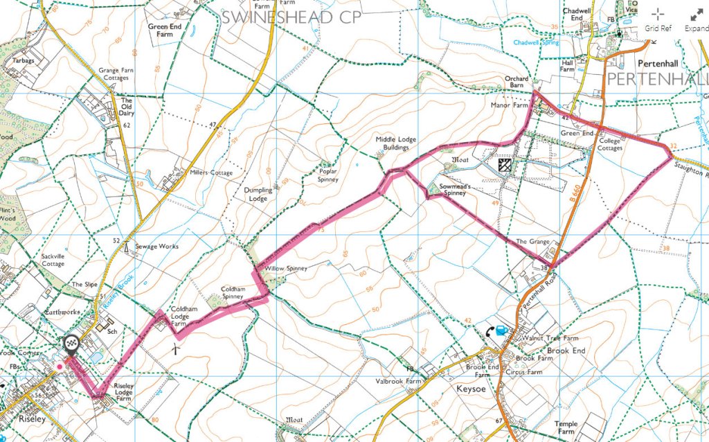
3.9 miles takes about 1.5 hours
This walk takes you past Riseley Church and over the fields, past Haring’s Farm. As you near the road near Knotting you pass the Oakley Hunt kennels. Turn left on the road and a few yards along you see the footpath sign, part of the Three Shires Way, on the right which takes you Yelden.

4.4miles taking roughly 1hour 30min
Can be a very muddy walk and I’ve not done it for a while so not sure about the stiles on the way. You pass the Chequers in Keysoe on the way. Some nice views as you go go from Coldham Cottages to Valbrook Farm over the gentle ridge.
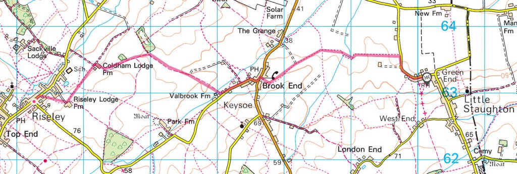
3.1miles roughly 1hour 10mins
A varied walk through the woods in Melchbourne and up the gentle incline as you head back towards Riseley over the fields. There is usually some interesting wildlife in the pond between Woodleys and Worley Wood so try to approach as quietly as possible.
After you’ve passed Worley’s Wood you’ll walk a short distance along the hedge then pass through the hedge on the left over a bridge across the ditch then head across the field. The path is usually clear to see across the field.

3 miles taking about an hour.
From Sharnbrook High Street across Pinchmill Islands to Felmersham and back alongside the Great Ouse. A lovely stile free walk that can include some refreshment at the Sun Pub in Felmersham.

3.9miles taking roughly 1hour 20min
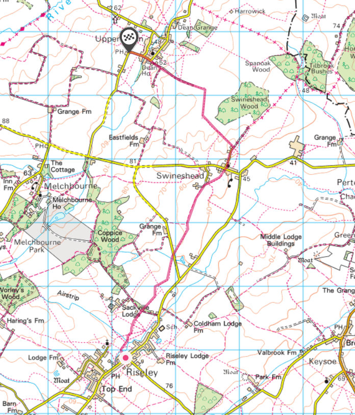
The best part of this walk is after you pass through the pretty village of Swineshead and head up to Swineshead Wood. Do pause when you get the top and take in the views.
Also do check the Three Compasses is open ready for your arrival and you have a pleasant end to your walk.